Showing posts with label 2019_Image_Galleries. Show all posts

Tuesday, June 15, 2021

Gallery: 2019 Grand Canyon Trip - Moab Area


Gallery (50 images): 2019 Grand Canyon Trip - Moab Area

This last gallery wraps up my 9300km, 2019 Southwest road trip with my dad! The last two days, before the long drive back home, were spent in the Moab, Utah area. This above gallery contains images taken in Canyonlands National Park, Dead Horse Point State Park as well as Arches National Park. On the drive back, the weather wasn't very good, so almost no photos were taken. In fact, we ended up driving through a blizzard with substantial snow on the ground, going over a long pass in eastern Nevada, and that was in mid-May!

Link to: All the blog posts from my 2019 Grand Canyon Trip

Finally, to end this last 2019 Grand Canyon trip blog post, here are six more expansive panoramas which will open in new windows or tabs when clicked.

Grand View Point, Canyonlands National Park...


A similar view as above, but with differing foreground and a wider field of view...

Buck Canyon Overlook, Canyonlands National Park...


Candlestick Tower Overlook, Canyonlands National Park...


Plateau Viewpoint, north of Canyonlands National Park...


Dead Horse Point State Park...


Thanks for viewing. The end!

Wednesday, April 28, 2021

Gallery: 2019 Grand Canyon Trip - Southern Utah Area


Gallery (25 images): 2019 Grand Canyon Trip - Southern Utah Area

This gallery contains images shot in southern Utah, in the vicinity of Mexican Hat. It was a leisurely day, first visiting a viewpoint looking down on the amazing loops of the San Juan River, at Goosenecks of the San Juan State Park. Next, we drove through a large portion of the Valley of the Gods, kind of like a "mini Monument Valley" in some ways, and there were lots of beautiful wildflowers blooming. Then, we drove back up the Moki Dugway to visit the Muley Point Overlook, since we ran out of time the day before. The photo of my dad near the edge of the cliff was nowhere near as dangerous as it looked by the way! Finally, it was an easy drive up the highway to Moab.

Link to: All the blog posts from my 2019 Grand Canyon Trip

Here is one panorama I stitched from Valley of the Gods, presented as a 4000 pixel wide image once you click on the thumbnail below to open it in a new window or tab...


Tuesday, March 9, 2021

Gallery: 2019 Grand Canyon Trip - To Mexican Hat


Okay, now back to blogging about my 2019 trip to the Southwest with my father! Working on these photos again, more than a year after posting the previous gallery from that trip, fills me with a longing to spend time in the desert once more, but unfortunately I'll have to wait until COVID-19 is thoroughly under control before venturing south again. 

The drive to Mexican Hat was lengthy and we took a completely different route than originally planned. I had wanted to drive the Burr Trail, in from Boulder, Utah, like we had the day before, then drive south through the Strike Valley / Waterpocket Fold area, taking the ferry across Lake Powell to Halls Crossing. Two things kiboshed that idea completely: firstly, there had been a lot of rain and the road south was apparently very muddy. I have experienced Utah mud in that area, and even with a real 4x4 with proper off-road tires, the mud can clog treads almost instantly and make driving nearly as bad as if you were on ice. My Outback had mere all-season tires, which I felt were certainly not up to the task. In addition, even if the road hadn't been muddy, I found out that Lake Powell's level was so low that the ferry was grounded and wasn't running at all. There are some shots of the nearly empty lake with more descriptive text in the gallery.

In the end, after driving through Long Canyon, then wending our way down into Strike Valley, we headed north instead, exiting Capitol Reef National Park to the east after spending a bit of time the park. Driving to Hanksville we turned south, eventually crossing the Hite Crossing Bridge, then finally down the crazy switchbacks of the Moki Dugway before arriving at Mexican Hat. That evening, we drove towards Monument Valley near sunset, and we happened across a heard of wild horses, which I carefully stalked and managed to frame with the Monument Valley spires and mesas in the background. The shot in the gallery was the best one, and also the last shot I got in before they finally had enough of me and galloped off...

Link to: All the blog posts from my 2019 Grand Canyon Trip

I shot a number of panoramas that day. Firstly, a near 180 degree shot in Capitol Reef National Park...


The next shot is just outside of Capitol Reef, en route to Hanksville. There were yellow wildflowers carpeting the desert, just beautiful!


South of Hanksville, there was a gorgeous view with red rocks in the foreground and some snow covered mountain peaks in the background, quite a nice combination...


Lastly, there are two views from the top of the Moki Dugway, looking east towards Mexican Hat...

Monday, February 22, 2021

Gallery: Hawaii 2019 - Wave Splashes


Gallery (45 images): Hawaii 2019 - Wave Splashes

On the last two days of our trip I was still very sick with the flu, so didn't feel up to doing much. I feel really bad for my father, who must have been really bored and disappointed! Basically, he and I went to a beach just south of the Kona International Airport, at Wawaloli Beach Park, and I stood there patiently waiting for waves to splash against the lava shelf. Much of the time my dad just waited in the car. The surf wasn't particularly impressive on either day, but when a wave hit the lava shelf in just the right way, some fairly impressive splashes could be seen. The above gallery has 44 images of wave splashes... kind of a lot, but then that will be the end of photos from the Hawaii trip. I intentionally used a very high shutter speed in order to freeze all the splashes, and sometimes, when the light was just right, some of the water globules almost look like they were formed from mercury and not just good 'ol salty H2O.

So, that was it for my Hawaii vacation. Soon, I will continue on with processing shots from my 2019 trip to the Grand Canyon with my father....

Link to: All the blog posts from my 2019 Hawaii Trip

Sunday, February 9, 2020

Gallery: Hawaii 2019 - Kona Bali Kai Views


Gallery (30 images): Hawaii 2019 - Kona Bali Kai Views

On the drive back from Volcanoes National Park the previous day, I started to feel really crappy and overnight, I developed a full-on, absolutely horrible flu, which lasted the rest of the trip and then at least a week beyond after returning home. Thank goodness the coronavirus situation hadn't yet begun, since I'd then have been rather worried that I'd somehow contracted that! My dad had a flu shot, whereas I didn't, and he actually did not get sick at all thankfully. We only got out of the hotel for food today, and all I had the energy for was to head down to the beach in front of the hotel, and do some long exposures of the shoreline with 10-16 stops worth of ND filters, photograph the surfers, and then later in the evening, take photos at sunset from the rooms lanai.

Link to: All the blog posts from my 2019 Hawaii Trip

Monday, February 3, 2020

Gallery: Hawaii 2019 - Volcanoes National Park


On this day, we drove quite a long way, all the way south and then east, nearly 2/3 of the way to Hilo, to the Kilauea Visitor Centre in Hawai'i Volcanoes National Park. From there we drove south along the Chain of Craters Road, which winds through many diverse lava fields, all the way to the south coast. There, the Holei Sea Arch stands watch and we also saw some very rare Nene geese, only found on the Hawaiian archipelago.

The Nene is apparently the rarest goose in the world and back in 1952, hunting and human introduced predators on the islands decimated the population down to only about 30 birds. Through strict conservation efforts, that number has increased to 2500 or so today, spread throughout several of the Hawaiian islands. Still 2500 is not very many, and each goose is tagged and identified. The roads that pass through areas where the geese frequent having warning signs and a reduction in speed limits. Temporary signs are also put up, warning motorists if geese are known to be in areas where they generally aren't seen. The geese are apparently related to Canada geese, but have a very unique, twisted pattern on their neck feathers. Seeing two of them close enough to photograph was a treat!

As you can probably tell from the gallery, I am fascinated by the diversity of formations that cooled lava leaves behind, especially the more fluid Pahoehoe lava which creates ropy, almost woven ripples, large pillow formations, and lots of interesting striations and grooves. Seeing lonely plants struggle to gain a foothold on the large lava fields really demonstrates the tenacity of life.

Here is one large panorama I shot, probably spanning a 150º field of view, where many overlapping lava flows of different ages have built up a large hillside. There is quite a variety of colours and types of lava visible in one shot! Click the image to open a much larger version in a new window...


Link to: All the blog posts from my 2019 Hawaii Trip

Tuesday, January 21, 2020

Gallery: Hawaii 2019 - North Coast


Gallery (10 images): Hawaii 2019 - North Coast

The above image doesn't really match the title of today's posting, but then I was fascinated by this view of the observatories on Mauna Kea for several reasons. More on that in a moment...

On this day, the weather was not very good with overcast skies and drizzle for part of the day. We first drove up to the north coast of the Big Island, to take in the views past Hawi, where the road ends and there is a trail going down to Pololu Beach. Since the weather wasn't great and I didn't want to leave my dad in the car for an extended period, I didn't hike down the steep trail at all. I only took a few shots from the road. After, we drove back to Kailua-Kona via the inland road, which leads through Waimea and then heads south along the western flank of Mauna Kea, past the Saddle Road.

Just south of Waimea, I was struck by the surprisingly clear view of the Mauna Kea observatories, and the fact that they didn't seem all that much higher than where I took the photo from, even though I knew them to be about 13,600 feet up, give or take! According to my GPS, and confirmed afterwards, the altitude at which I took this photo at was only about 2,600 feet, so that means those observatories were 11,000 feet higher than where I stood for the photos! That blew my mind since at the most, it visually seemed like they were only maybe a 3,000 or 4,000 feet higher than where I stood. The telephoto lens I used certainly magnified that impression too.

The peak of the small volcanic cinder cone (probably more of a splatter cone) that you see in the foreground, called Holoholoku, is at 3,265 feet, or only 665 feet higher than where I stood. However, that peak is a mere 4.8 km away whereas the observatories were 29 km distant. So perspective and telephoto compression really serve to give quite an illusion here, at least to my eyes! Maybe you'll see it differently?

For fun, I tried to figure out which observatories one is seeing and after studying a map of the Mauna Kea observatories and judging by the angle I was shooting from, I came up with the following: from left to right we have...

Canada-France-Hawaii Observatory
Gemini Observatory
University of Hawaii 2.2 Meter Telescope (the one with the dome protrusion)
The twin Keck Observatory domes
Subaru Telescope

Since even back in 2008, my dad did not feel well at the high altitude of Mauna Kea's summit and we had to cut our visit there short, this year we decided not to drive up at all. One day, I want to return there and photograph all the observatories up close...

Link to: All the blog posts from my 2019 Hawaii Trip

Sunday, January 19, 2020

Gallery: Hawaii 2019 - South of Kona


Gallery (80 images): Hawaii 2019 - South of Kona

On this day, I spent a lot of time photographing palm trees at the challenging to pronounce (a tongue-twister really) Pu'uhonua O Honaunau National Historical Park. I love palms, the spiky arcs of their fronds, their often curved and crooked trunks, and especially the shadows they cast on the ground. The last time I was at this park back in 2008, I didn't take very many photos since the one time we were there, it was mostly overcast, and I regretted at the time not being there when the weather was better. This time I made up for it, as you'll see in the gallery! Generally speaking, the weather on this Hawaii trip was fantastic, which made for many great photo opportunities.

On the last trip in 2008, I also missed out and didn't visit the St. Benedict's Catholic Church, better known as the famous "Painted Church" since my dad and my aunt went there on the day I got sick and we never went back after. This time my dad and I went there and he patiently waited while I took tons of shots inside and out. I also walked back along the road to photograph a palm tree that seemingly was confused about which way it was supposed to grow! Another shot in the gallery right after, shows a frequent occurrence on the Hawaiian Islands, where the lush tropical greenery starts climbing up and along power poles and power lines.

Later that evening after dinner, we drove down to Milolii again after dark, to visit my mom's memorial one more time and to see the solar powered LED roses lit up at night. I took a bunch of photos but my favourites were at the end, when I started using a flashlight to selectively light-paint, in order to highlight the coral stones of the memorial and the bushes in behind. I had many different versions, with a few different ones in the gallery, and my overall favourite one is shown below. The real red roses we put in the vase, the ones on the left, were already looking rather wilted after being out in the hot sun for a day. A larger version of the below shot can be seen in the gallery of course...


Saturday, January 4, 2020

Gallery: Hawaii 2019 - Milolii and South


Gallery (30 images): Hawaii 2019 - Milolii and South

On this day, my father and I visited my mother Ingrid's memorial, just outside the village of Milolii. The white coral, which my aunt, my father and I placed back in 2008 after we had scattered my mom's ashes in the ocean near there, has turned a dingy shade of gray over the last 10 years. I decided to flip all the coral pieces over to expose their somewhat whiter undersides, which has been done in the above shot. I helped my father up the lava and gave him my camp chair to sit in while I hammered in the stakes that hold up the two solar-powered LED rose bouquets. The red roses on the left are real. Originally, the memorial looked different, with my mom's full name spelled out, but then it was vandalized at some point. A few years back, when my father and Franziska were in Hawaii, they fixed it up and simplified it to just my mom's initials.

To see some images of the original memorial, see my blog posting from 2008 here (opens in a new window)...


After fixing up the memorial, my dad and I headed to the south coast of the Big Island, where (very important!) we visited the famous Punalu'u Bake Shop that serves up some amazing pastries and donuts. We had lunch there, each having a coffee and three donuts... which we both decided was at least one donut too many. They were big! Not a particularly healthy lunch that day, but it was good...

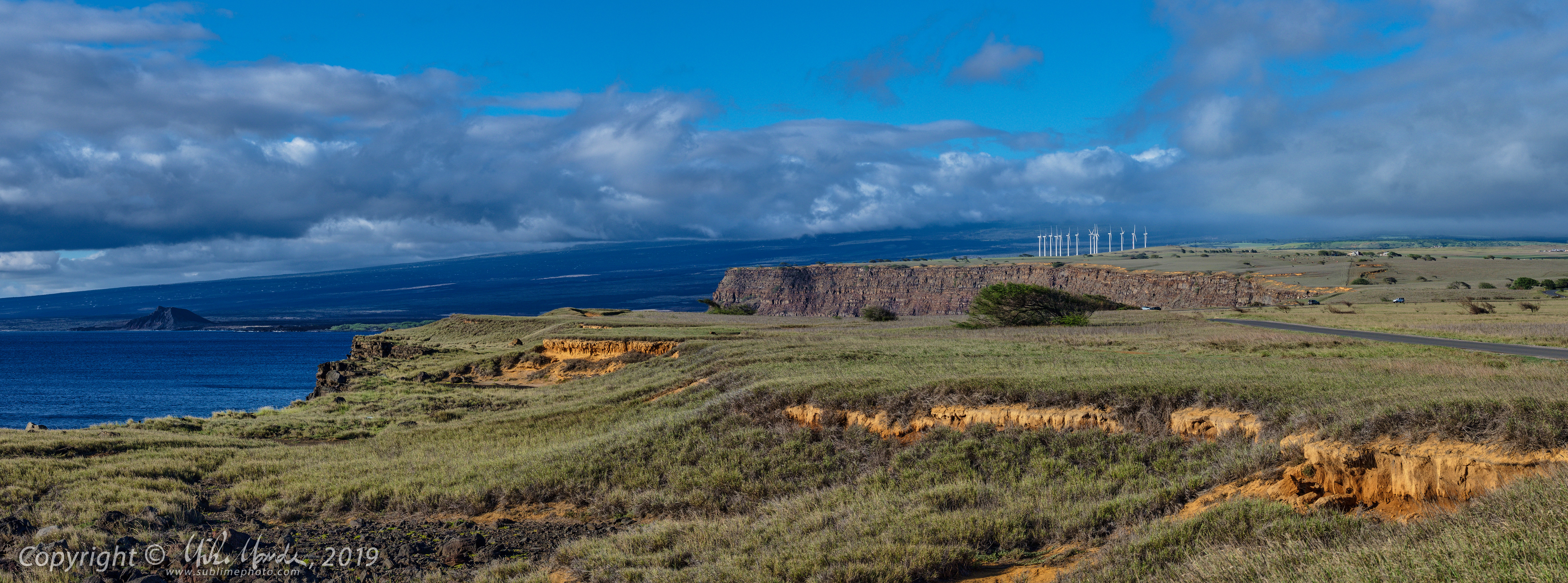
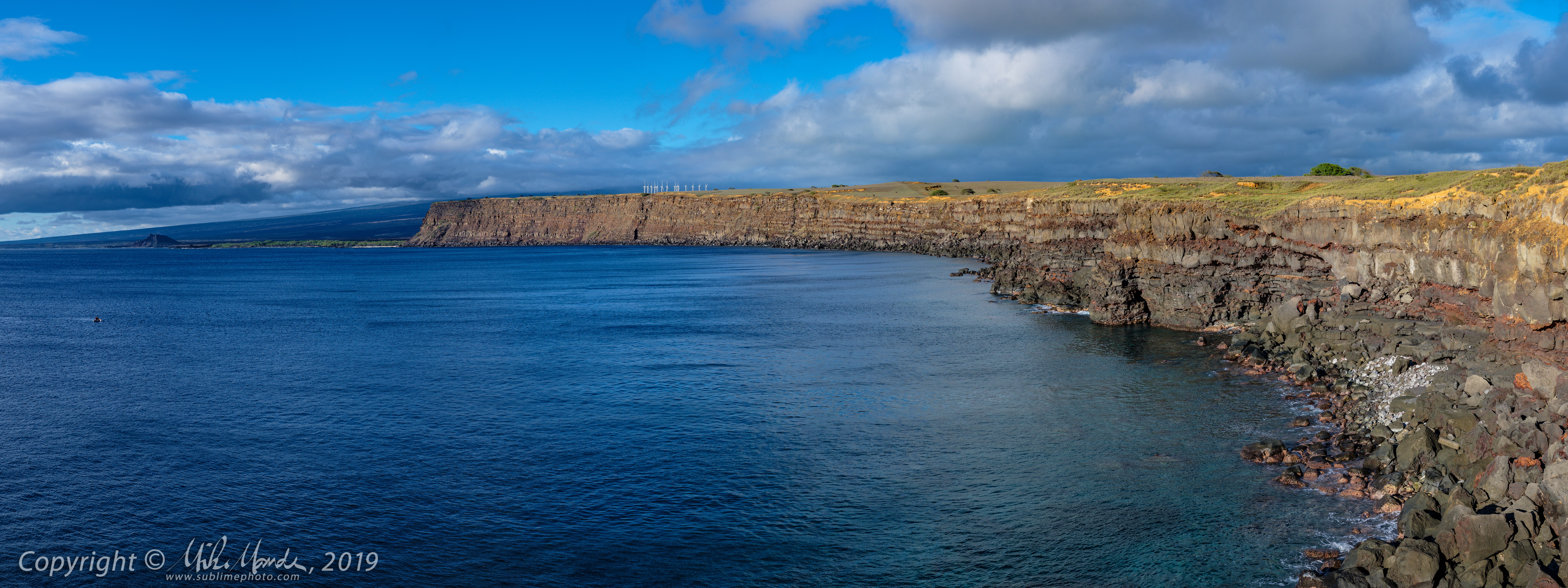
We also stopped at the parking area where one can hike to the Green Sand Beach near South Point, and I took numerous photos of the coastline there. Below are two panoramas I shot from there. When you click them, they will open larger in a new window.


When you open this next one, and also in photo 23 of the linked gallery, you can really see the many layers that make up the island's landmass, seemingly made of alternating Pahoehoe and A'a lava flows. In some areas, it makes the coastline almost look like someone has cut into a gigantic cake...

Sunday, December 29, 2019

Gallery: Hawaii 2019 - Old Kona Airport State Park


In early December, my father and I left on a ten day trip to the Big Island of Hawaii. We wanted to visit my mom's memorial near the village of Milolii on the Kona Coast, the west side of Hawaii, where her ashes were scattered in the ocean back in 2008 following her long struggle with cancer.

On this first mostly overcast and occasionally rainy day on the Big Island, we decided to visit the Old Kona Airport State Recreation Area, which is the official name as near as I can tell. When you search the Internet, there seem to be numerous other designations: Kailua-Kona State Park, Old Kona Airport Botanical Gardens, Old Kona Airport State Park (this one gets my vote!), Old Kona Airport Beach State Park and more.

In any case, this is the site of Kona's old airport, before the new Kona International Airport opened way back in 1970. The old airport's runway is now a long parking lot for beach goers and for joggers and walkers who wend their way through the lush gardens there. This isn't a private botanical garden, however it seems like there are many locals that have adopted a plot of garden to maintain and enjoy, so there was quite a variety of plants, including many cacti. There first shot even shows someone's preparation for Christmas!

Some might be surprised to see cacti on Hawaii, but there are 8 distinct climate zones on the Big Island, including fairly large semi-arid and arid desert areas on the northern west-coast, in Mauna Kea's and Mauna Loa's rain shadow.

My somewhat regular recent blogging was interrupted, firstly due to the trip, and secondly since I unfortunately came down with one of the worst flus I ever had, about four days into our Hawaii trip. I felt terrible for weeks and I've only recently recovered enough that I feel like myself again!

Link to: All the blog posts from my 2019 Hawaii Trip

Saturday, November 16, 2019

Gallery: 2019 Grand Canyon Trip - Burr Trail


Although this gallery is called "Burr Trail", almost half the photos were taken further west, on the drive there from Bryce Canyon, many near Escalante, Utah. We did detour to visit Kodachrome Basin State Park, which has many spindly rock formations, with some being rather, ahem, phallic in nature. The park's name has an interesting history too. The Burr Trail is a wonderful back-road that gets you into Capitol Reef National Park, much further south that the main park road that most people drive through. A number of years back, this road was completely gravel and that added to the desolate feeling of the amazing scenery but alas, it is now paved right through the spectacular Long Canyon, the entrance to which you can see in photo 30 of the above linked gallery.

The canyon rocks are a rich red-orange colour, and there are many lush green trees, so the combination of red rocks, green trees and a deep blue sky, like it was on that day, is an incredible sight to behold. The colour contrasts really make for spectacular scenery! Near the eastern end of Long Canyon, where it opens up, the varied colours of the sandstone are even more amazing, and the eroded mounds you can see in the above photo are a landscape photographer's dream. I will admit to enhancing the colours on the above photo to make it seem a little more "Velvia-like" but the version that's in the gallery (photo 43), as well as the other shots in the gallery, are more realistic.

Still, incredibly vivid colours in the area when you see them in person, especially when the clarity is as good as it was that day. We had so much luck on the trip, often with the atmosphere scrubbed clean of dust and haze by recently passed storms, deep blue skies and fluffy white clouds, as well as some interesting stormy skies as well. This was another place my father had never seen and the weather couldn't have been better for it!

Link to: All the blog posts from my 2019 Grand Canyon Trip

Here are some more panoramas I shot that day and again, clicking a thumbnail will open the shot larger in a new window or tab. The first one was taken from a viewpoint east of Escalante...

The next one was from atop some rocks beside the parking lot at a viewpoint overlooking the Escalante River...


Lastly, here is a panoramic photo of the view at the exit of Long Canyon...

Monday, November 11, 2019

Gallery: 2019 Grand Canyon Trip - Bryce Canyon


After the main event, the Grand Canyon visit, we started working our way north again. The next major stop was Bryce Canyon National Park in southern Utah. On the way, we drove past the spectacular Vermilion Cliffs in northern Arizona. Much of drive out of the Grand Canyon area was bad weather, with very poor visibility and blizzard-like conditions. However luckily things improved and I did get a decent view and took one panorama of the Vermilion Cliffs. Too bad the sun wasn't out more for a bit of extra contrast, but it was still worth a shot. Click on the following to open a larger version in a new window or tab...


At Bryce Canyon the next morning, we were dismayed to find the weather cold, overcast and foggy, with fresh slushy snow on the ground! Since our strict schedule only allowed for one day at Bryce, I feared that we might not get any decent views at all. I took the opportunity during the day to do a load of laundry, while my dad relaxed back at the hotel. However when I was done, the skies had started to open up and I rushed back to the hotel to fetch my dad. We drove out to Sunset Point and the views were spectacular! Once again the the clarity was superb and the evening light was amazing - what luck! However it didn't last for long...

All the evening images in the gallery were shot during a brief 21 minute window when the sun was out. I was frantically shooting and changing lenses to try and capture as much as I could. Also, rather that depend too much on wide-angle lenses, I decided to shoot more details this time around, using my XF 50mm f/2 and XF 90mm f/2 for many shots, two exceptionally sharp lenses. In fact, the one shot in the gallery from my 16mm lens was actually slightly mis-focused darn-it! I felt so pressed for time that I didn't review any images when I was there and didn't notice it unfortunately.

Link to: All the blog posts from my 2019 Grand Canyon Trip

Despite the brief period of good light, I did manage to squeeze in a few panoramas as well. This first one ended up being over 21,000 pixels in width for the original file, enough to easily make a 10 foot wide print. The second one, which I shot from a slightly different spot with a wider lens, showing more foreground canyon and sky, makes up for the ruined 16mm shot I'd say...


Saturday, November 9, 2019

Gallery: 2019 Grand Canyon Trip - The Canyon!


This, finally, was the ultimate reason for our trip, the main event. My mom and dad had, on two separate trips, driven down to the Southwest and visited the Grand Canyon, and both times it was socked in with clouds so thick that you couldn't even see the canyon at all. So this was on my dad's bucket list, the wish to see the Grand Canyon in all its glory. The evening we arrived, it was overcast and raining, and the next morning didn't look all that promising either, but after we had breakfast it started to clear...

The passing storm had done a fantastic job of cleaning the air of dust and the views were the clearest I'd ever seen at the Grand Canyon myself. I had been there maybe three or four times previously, but the clarity this time was outstanding. To make things more interesting, a midday storm decided to scour the air even further and later that evening the views were, if anything, even better than in the morning. We had lucked out and had a day of gorgeous weather, absolutely fantastic for taking photos!

We were hoping to take in some more views again the next morning, but alas it was not to be: in fact, we had extremely poor visibility in blizzard like conditions on the drive east out of the park! The one day we were there, the weather was fantastic but the day prior and the day after, terrible weather with virtually no visibility into the canyon. Indeed, Lady Luck had smiled upon us that day for sure!

To get a good sense of just how vast the Grand Canyon really is, click on image #33 in the above linked gallery and then open the larger 3000 pixel wide version. Find the person standing near the edge of the cliff near the upper right of the shot...

Sadly, my mother passed away in 2008 and never did get to see the canyon like this in person. Neither did my dad's more recent companion Franziska unfortunately, who suddenly passed away in 2018. She too really wanted to see the Grand Canyon in person and the three of us had actually planned on doing this trip in 2017. Unlike my mother, Franziska had never been to the US Southwest at all. However that year, my dad had some serious health issues and couldn't really travel, nor could he get medical insurance for travel outside of Canada, so we had decided to postpone this trip until after our planned trip to Germany in 2018. Since Franziska sadly passed away early last year, my dad and I ended up traveling to Germany on our own as well.

Link to: All the blog posts from my 2019 Grand Canyon Trip

Below are a few stitched panoramic shots, a little too wide to look good in the main gallery, although not as wide as some I had posted previously. Since I couldn't decide on just one, the last three are similar versions of the same view, shot with different lenses at slightly different times. Click on the image to open a larger view in a new window or tab...


Tuesday, November 5, 2019

First Test! Fujifilm X-Pro3


Gallery (30 images): First Test! Fujifilm X-Pro3

These are the first tests I shot with a preproduction X-Pro3 body that was loaned to me by Fujifilm. These may also be my last tests since for the moment, I have no intention of buying an X-Pro3 once it is released at the end of this month. Fujifilm intentionally made some design choices for the X-Pro3, with the hopes of attracting a new class of customer, and those choices mean it's a camera that is not very appealing to me. Time will tell if they made the right move. In the meantime, I am still extremely happy with my X-Pro2 body and more recently, with my X-H1 as well. The in-body image-stabilization, really superb EVF and general handling of the X-H1 I find to be very good, even though inherently, I prefer the control layout and handling of a rangefinder style body like the X-Pro2.

In the future, I may elaborate further on what it is I don't like about the X-Pro3, but suffice to say for now it is mainly the hidden-by-default flip down rear LCD, the reduction in the number of customizable buttons, and the significant reduction in the Hybrid-Viewfinder's OVF functionality in order to make room inside for a slightly improved EVF. There is a slight increase in magnification when compared to the X-Pro2, and a substantial improvement in contrast and smoothness, but I feel the EVF is still nowhere near as good as the one in the X-H1 or X-T3, and the improvements are not enough to compensate for the compromises made with the OVF in my opinion.

Sunday, October 20, 2019

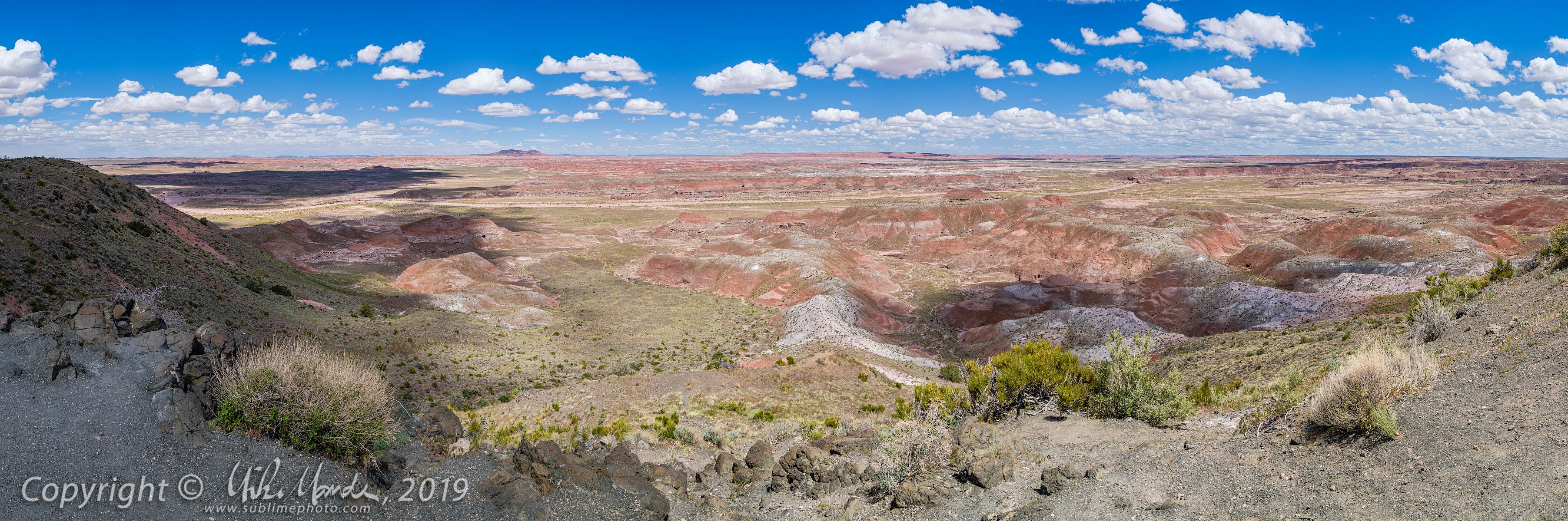
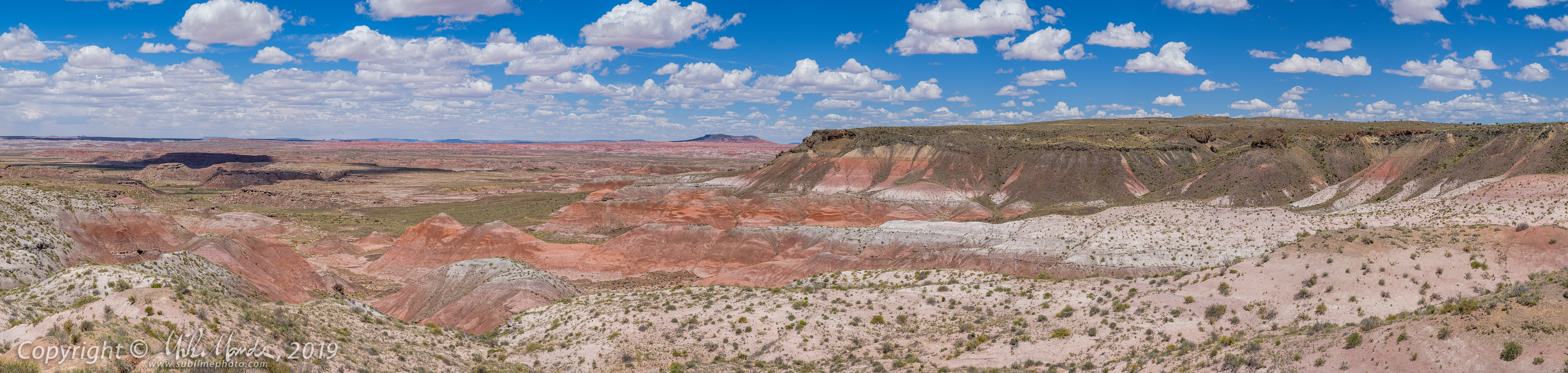
Gallery: 2019 Grand Canyon Trip - Painted Desert


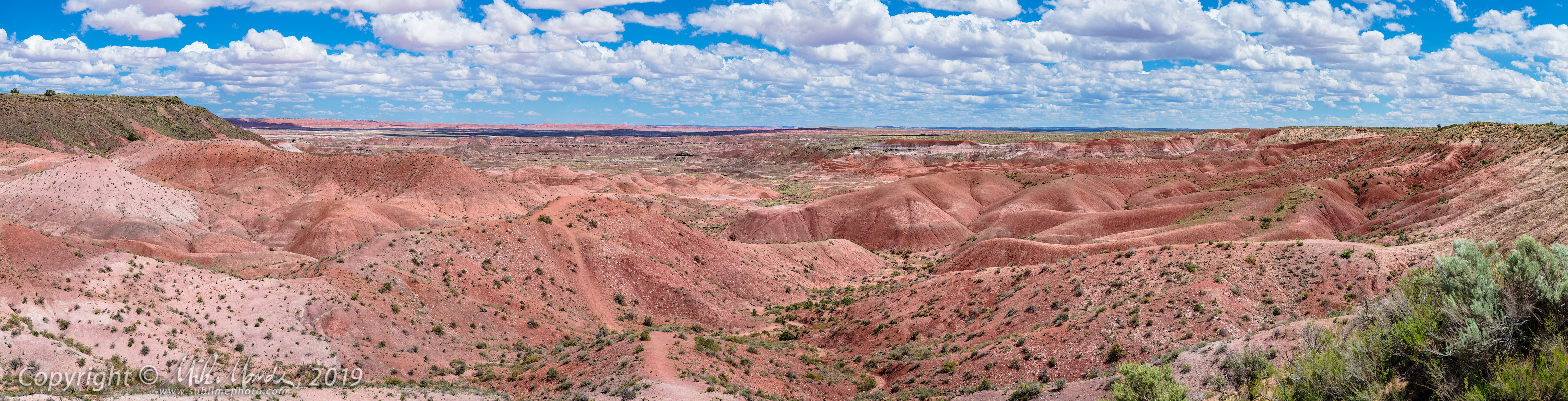
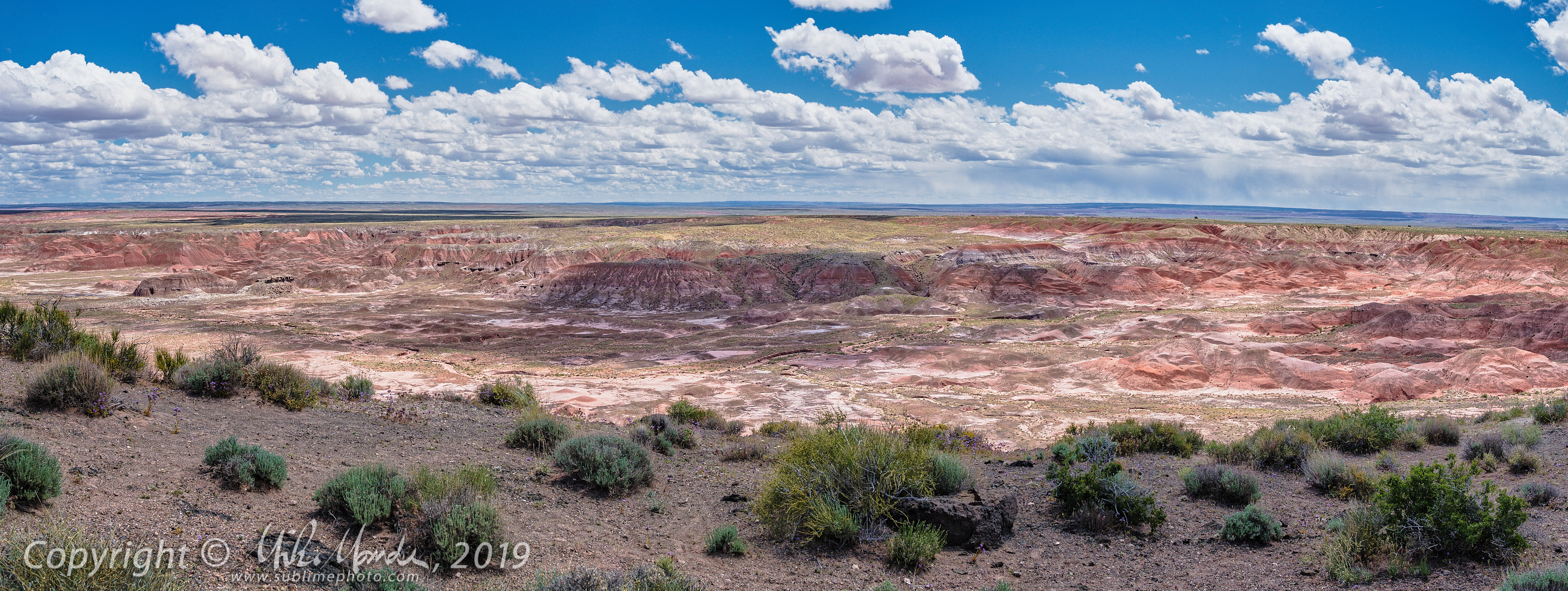
On the the way from Los Alamos to our ultimate destination, the Grand Canyon, we had one more stop to make at the Petrified Forest National Park. We did the drive from the north part of the park to the south, and got lots of wonderful clouds floating over the amazing Painted Desert scenery there. The desert is so richly colourful, that on some shots you can actually see the closer clouds reflecting the deep red, giving them slightly pink undersides.

Unfortunately, once we got to the south end of the park, where all the amazingly colourful petrified logs were, the sky had become total overcast, story and windy and starting to rain. So, unfortunately, apart from a few quick iPhone snapshots I took, running up to a viewpoint quickly to check the weather on the horizon (it wasn't good), I did not get any shots there this time around. Note that the petrified log and fragments that you'll see in the above linked gallery are nowhere near as brilliantly colourful as the agatized logs in the south end of the park.

Link to: All the blog posts from my 2019 Grand Canyon Trip

The expansive landscape in the area just begged for panoramic shots, and I did numerous stitches that turned out to be rather wide, too wide for the regular gallery in my opinion, so you can view them below. Clicking on the image will open a much larger version in a new window or tab, 1200 pixels tall by however wide they end up being.

These panos were solely processed in Adobe Lightroom, apart from downsizing in Capture One, with the original raw files being run through Adobe's new "Enhanced Details" demosaic process first, before being stitched into a panorama. This seemed to yield slightly better images with less stitching artifacts, when compared to using Capture One Pro to generate TIFF files and then going back and stitching those in Lightroom. In case you were wondering (and you probably weren't!), the 'E' in the filenames designate that I used this new Adobe feature before stitching the panoramas...


Wednesday, October 16, 2019

Gallery: X-H1 Night Walk & Fall Colours

Gallery (60 images): X-H1 Night Walk & Fall Colours

Interrupting my posting of Grand Canyon trip images, the above gallery contains two sets of images taken on different days. The first is a walk home from work, along False Creek and through the Olympic Village by Science World. I was shooting with my Fujifilm X-H1 and XF 23mm f/1.4 lens. All the shots were handheld, taking advantage of the X-H1's in-body sensor-shift image-stabilization (IBIS), which can be effective down to as long as a 1 second exposure with something like that 23mm lens. Mind you, reliable 1 second long handheld exposures are still not easy, even with the X-H1's IBIS, but I found a pretty decent hit rate for sharp 1/2 second exposures, and shorter of course. The freedom and speed of shooting that not needing a tripod brings is liberating!

Of course, being completely dark out, I still needed to use ISO 1600 since I also wanted a bit of depth-of-field, deciding to shoot most images at f/4. Had I used a tripod at ISO 200, of course the noise levels would have been less, and the dynamic range and overall image quality would have been better. However, I usually don't decide to walk to work with a tripod, unless I have preplanned a shoot and this was not planned. In short, X-H1 still made it possible to capture rather decent cityscape images in complete darkness, even without a tripod.

Lastly, note that all the images are geotagged, but the X-H1 shots were not tagged in post like I normally do. Instead, I utilized the X-H1's auto-reconnecting Bluetooth interface to my iPhone, and it pulled my location from the phone for each shot. Note that to conserve the battery, I was constantly switching the camera on and off, and at the time I wasn't even concerned with geotagging so didn't give the camera any extra time to connect. In the end, every single shot on that walk home had location data, which is rather convenient!

On my recent trip to Oregon and Idaho, I did use my Garmin Fenix 5 Plus watch to record tracklogs, and then used Lightroom to geotag the images from the X-H1, since I usually didn't have the phone with me. This was the first time I noticed how surprisingly quick and reliable the phone-connection geotagging seems to be was. Cool. That said, some of the X-H1 geotag positions in the above gallery are off by a little more so than I would normally expect, for example, my Garmin to be but I'm not sure if that was due to natural variation in GPS accuracy, or the fact that sometimes I took a shot only a few seconds after flipping the camera on. Maybe if I had waited a little longer after powering up the camera, or just left the camera on between shots, the geotags would have been more accurate?

The second set of images in the gallery was from my X100F, on the evening I walked to the advance polls for the upcoming Canadian federal election. At the last minute, I decided to grab my Fujifilm X100F on the way out the door and I'm glad I did. Many leaves were already changing colour and with the low evening light, the colours and contrast popped!

Clicking on either above image leads to the same gallery, with the first 35 shots being from the nighttime walk with the X-H1, and the last 25 shots the fall colours with the X100F. As mentioned, the X-H1 shots were auto-geotagged but the second set of images from the X100F were tagged manually in Lightroom like I always do. All the images were ultimately processed in Capture One Pro though, not Lightroom. For those X-H1 shots, Lightroom would have yielded cleaner images with less high ISO grain (noise), but at the expense of detail and sharpness in many of the darker areas of the images. Personally, I do prefer the slightly grainier but more detailed images...

Sunday, October 13, 2019

Gallery: 2019 Grand Canyon Trip - Los Alamos


For the first part of the day, my dad wasn't feeling well after a night of sleeping poorly, and stayed in the hotel while I went out and wandered around Los Alamos for a few hours. I visited several buildings belonging to the Los Alamos History Museum, and took a number of shots around the scenic Ashley Pond Park, as well as other historic sites in the city.

Later in the day, my father mustered the energy to visit the very interesting Bradbury Science Museum with me. My Laowa 9mm lens came in handy to add some wide dramatic perspective to some of the museum's displays, even when the space was tight. Afterwards, I had been looking forward to driving to Bandelier National Monument, which features a large number of fascinating cliff dwellings and other ruins, but after the museum, my dad had enough for that day and just wanted to rest and relax in the evening.

Link to: All the blog posts from my 2019 Grand Canyon Trip

Saturday, October 12, 2019

Gallery: 2019 Grand Canyon Trip - VLA & Bosque del Apache


After a day of travel with no photography, just driving across central Arizona and making time, we arrived at the Very Large Array (VLA) radio telescope facility in New Mexico in the evening. The interesting thing about the VLA is that there are many radio dishes arrayed along three sets of twinned railway tracks that radiate outward in a "Y" shape. The dishes can be moved along these tracks and repositioned to either be close together near the centre, or much further apart across the entire valley, depending on the scientists' needs. The tracks are each about 21 kilometres in length, allowing for huge flexibility in positioning the individual dishes.

In the above photo, you can see one of the rail transport vehicles that helps move the dishes, with one showing in the assembly and maintenance building in the background. It might be a bit hard to tell the scale, but the individual radio dishes are actually quite large, being 25 meters in diameter and each weighing over 200 metric tons!

The following day, before making our way up to Los Alamos, we stopped by the Bosque Del Apache Wildlife Preserve and walked around a little, observing many different birds... and one turtle as well. During past visits, I saw many more turtles basking in the sun, but I only glimpsed a single one that day...

Link to: All the blog posts from my 2019 Grand Canyon Trip